

I woke up Saturday morning around 6am with nothing planned for the day. I was just going to relax, catch up on blog posts and maybe watch a few movies. Unfortunately, my brain was not in agreement of any of those things. It was supposed to be really cold out, about -30 with the windchill but sunny and I just had to get outside anyways!

Since my last trip at the end of December, testing out the tipi at Mew Lake, I had been toying with the idea of renovating the tipi AGAIN! This time, instead of the poles, it was the canvas that needed some revisions. Living in Muskoka has it’s perks but one thing we don’t have are a lot of popular stores nearby, one being Fabricland. The closest one to me, was 45 minutes in Huntsville, or an hour to the ones in Barrie or Orillia.
Seeing as I was going to drive an hour to go to a store, I figured I should also take on an adventure in the area. No point in wasting an entire day without an adventure right? I went online while still in bed, haha, at around 6:30am and I searched hiking trails in Orillia. I located one called Scout Valley Loop Trail which was small but perfect for what I wanted to do today.

I desperately wanted to stay in bed and enjoy a sleep in but my body rebelled and threw off the covers. Guess I was getting up and heading out? I packed myself a lunch, made a breakfast sandwich, ensured I had everything I needed in my backpack and put on lots of layers of wicking clothes. I warmed up my car, cleaned it off and I was on my way!

As it was so cold and had been snowing constantly the last few days, I decided to take the main roads. The sun was on it’s way up and out and it looked like it would be a gorgeous day! I was somewhat sad I wasn’t still in bed, but excited to be on my way to a spontaneous adventure.

When I turned off highway 11 and realized how close the trail was to it, I was a bit concerned. I wanted to at least feel like I was in the woods and I hoped I would get that. You never knew what you were getting when you embarked on a new trail in a new area. With little research, I could only hope it would be at least slightly as I’d hoped?


When I arrived at the parking lot, I was still concerned. There was a small cabin just in from the parking lot and behind it, what appeared to be a sand lot or gravel quarry? I wasn’t 100% sure but it did not look foresty at all.


I was here now so I put on my snowshoes, snowpants and jacket. As I had driven an hour, I saved my last layer to put on when I got to the park. I did this often so I wouldn’t get too warm in the car, then freeze when I got out and so far it worked fairly well.


I ran into a women in the parking lot with a dog and I asked her how the trails were. She said they were really pretty but not well marked. She said I would need a map if I was going to do all the loops, or I could get a bit lost, but eventually, I would find my way back. Good thing I screen shot the map and had it with me.


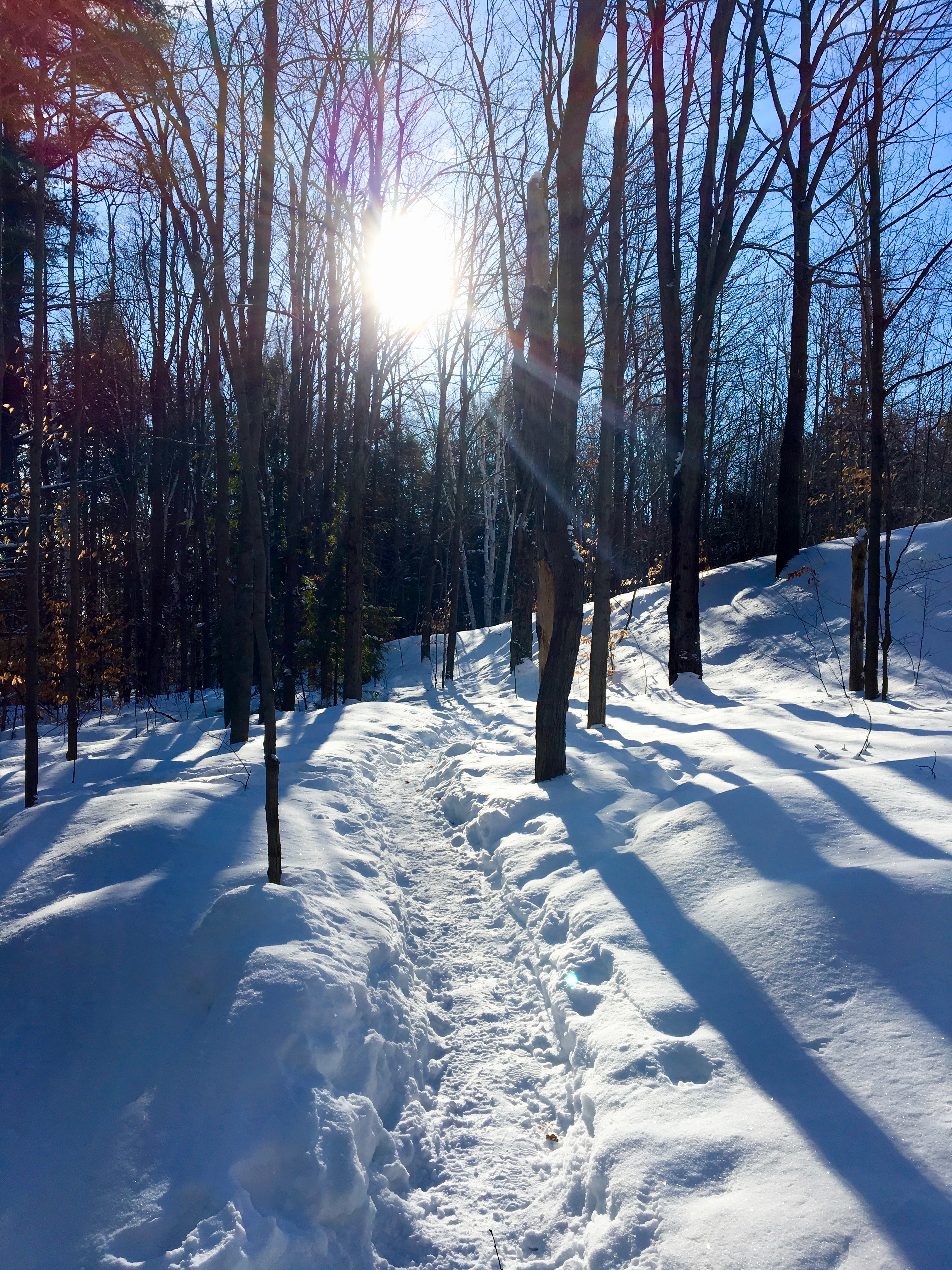
I started on the trail excited at what I would find. I quickly realized that the trail was very packed down from many people visiting the last few days and the snowshoes were not really required. After walked in them, creaking due to the packed snow, I finally gave in and took a few minutes to remove them and strap them to my backpack. Then continued on.


Scout Valley has 3 trail loops that all interact with each other. Each trail is 2km’s long, making a total of 6km’s. Nothing extreme but the main point of the day was to find fabric for the tipi and go to Fabricland so for this occasion, it was perfect.


I really enjoyed the trail and was surprised it was so forested once I hiked in a bit. I could hear animals in the forest, but of course, could not see any. I stood still for about 15 minutes in one spot, but couldn’t see any wildlife and as it was so cold, I had to keep moving and give up my quest.
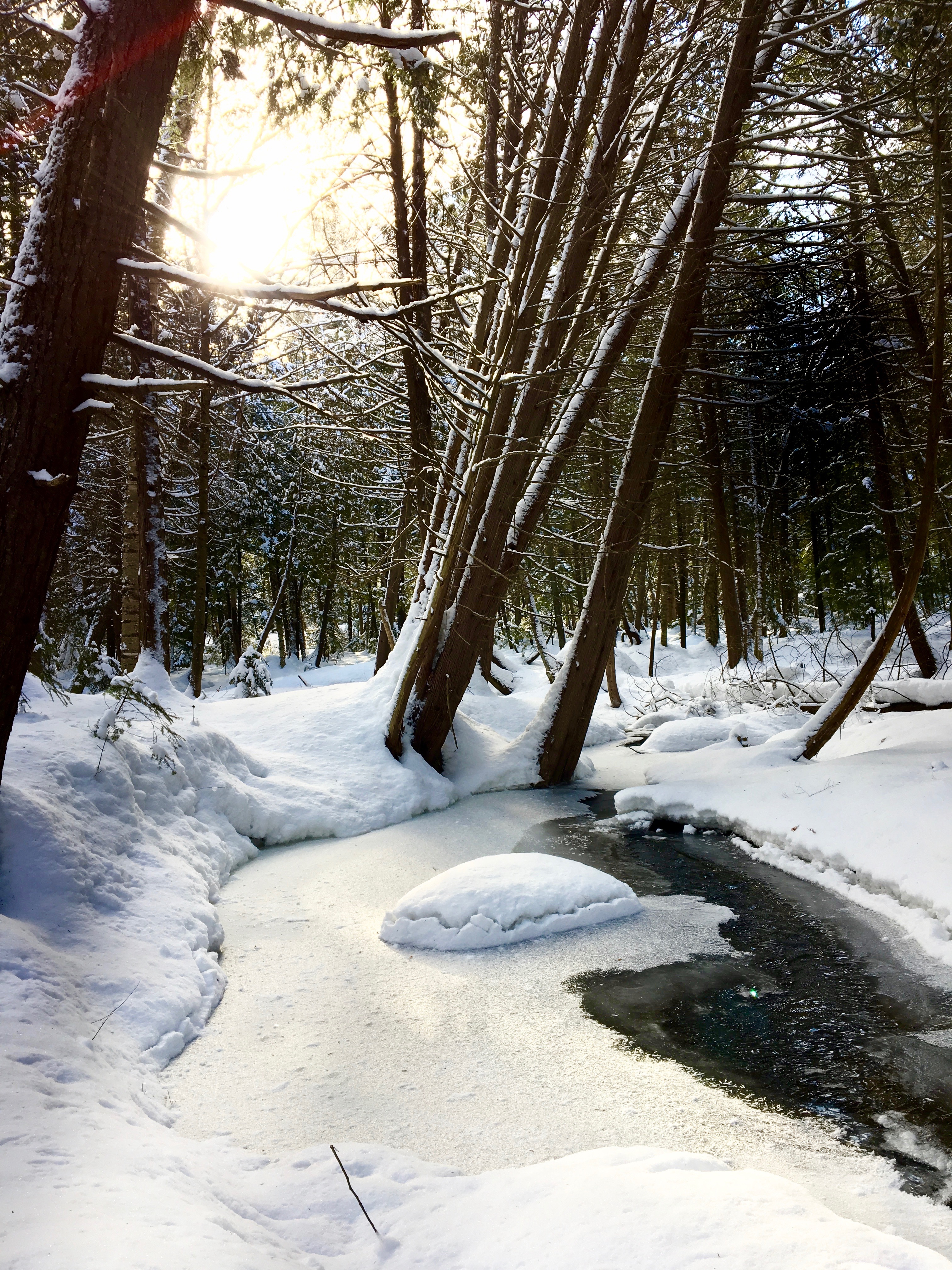
The sun was shining and it felt warm on my skin but the wind was also blowing and reversing the effect. Regardless, after camping in February in -42, temperatures like today, didn’t seem so scary or cold to me anymore. I came across lovely little creeks, waterfalls and scenes that made me feel like I was truly in a winter wonderland.
I was very surprised as I knew I wasn’t far from the city, but I was far enough to not hear the traffic of the highway on most of the trails, and otherwise felt like I was in a remote forested area.


I was truly happy I had come here and didn’t listen to my concerns when I had arrived.


Throughout the trail, I came across areas that were tamped down well and just walked in my Keens and other areas that were deep with snow and had to put my snowshoes back on. I think I took them on and off a total of four times throughout the trek.


Every time I put them back on I’d believed they would stay on, but as I approached a different trail loop or section, the trail would be too clean for them and I would have to take them back off. I did get more practice taking them on and off quickly and found using a tree to assist me helped alot. My trees were always there for me!! LOL


I came across quite a few crossroads along the trail where I had no idea which way to go. As my map showed me to continue taking the most left routes, I did that and seemed to make out okay.


The woman with her dog was correct though, the trails were not marked except for a section at the other end which I believe is where the trail runs along the Ganaraska Hiking Trail and I believe the markers were for that.

Thankfully, I had snow and you could always follow tracks in the snow to lead you back to where you came from.


Also, the park was very small and I knew that regardless, I would come out sooner or later where I needed to be.


I did notice that my map and compass skills were in full effect automatically. Without thinking, as soon a the woman told me about the markers not being present I had begun in my brain to take note of things, just as I was taught in my Map and Compass Course at Frontenac. I had taken note of the sun and where it was positioned when I left the parking lot. I had realized the wind direction and which way it was going in relation to where I’d started. I took a screenshot of my google map placing me where I needed to return to and although the trails weren’t on that map, I could see where I was in relation to the blue dot I’d took a photo of and this would help me return.

I took note of the highway sounds and which direction they were in relation to me when I left the parking lot. Took a few photos of the skyline and treeline where I was. All of these things would assist me in the event that I got lost and needed to find my way back. I only used them twice, at two different crossroads where I wasn’t quite sure which way to go, but they definitely helped me and I had to remember to always do my best to take note of things as you never know if/when you might get lost and need to use your skills to find your way back.

Again, it was only a 6km set of trails, but people say most accidents happen within a few km’s of your home, so I associate that with this in that respect. You never know, and it’s always better to be safe than sorry.


After about an hour and half, I had stopped many places to wait and see if wildlife would emerge and to take some photos, I was back at the part of the trail I’d started at.


I headed to the parking lot, almost sad I was already done. It was cold but it was so fresh and crisp out and I honestly wished I could keep going. But, I had a mission today, so I resigned to my wishes and took off my snowshoes.


As I was removing layers and preparing for my visit to the store, I noticed a group of people gathering in the parking lot. I asked a woman if they were some type of hiking group and she said, well, sort of. We are the Kasual Kayakers, with a k. We kayak in the warm weather and do some meetups to snowshoe and hike in the off seasons. She told me her website and I save the link to share it with you guys and also gave her my card in turn. After a brief chat, I said goodbye to Cindy and the group, took a few last photos of the sign for the post, and headed off to Fabricland to see if I could find the solutions I needed for the tipi.

If you get a chance to explore these trails, I would definitely recommend you give it a go. They are not long or difficult but very pretty and I believe it would also be a lovely place to visit in the other seasons.
I hope you enjoyed my visit to Scout Valley Loop Trail in Orillia! If you have any questions, comments or just want to say hi, please leave a message.
Happy Hiking/Snowshoeing!
Camper Christina
Looks like a good couple of hours well spent. We’ve driven by that spot hundreds of times, always saying “we should go there sometime.” Now that I’ve seen some pictures, looks like should put it back on the list.
I think you should too! It’s not a big long hike, but a very pretty one. I’m hoping to see some pics from the warmer months but no one has posted any as yet. Thanks for checking out the post! Hope you are well! 🙂
Wonderful photos. I have walked Scout Valley trails scores of times. Each season brings its own beauty. Spring is particularly interesting with all the varieties of new growth.
Thank you so much for checking out my post and for the comment! I was curious what it looked like in other seasons?. I guess I’m going to have to go check it out? Have a great night !!
[…] I left Port Carling at 715 to meet her at 830. My original plan was to go to Fabricland after our adventure, but with the stores closing at 5 and the need to spend more than a few minutes there, I’d decided to go the day before in combination with my visit to Scout Valley Loop Trail. […]
[…] winter I spent a few hours exploring the Scout Valley Loop Trail . After I put the post up, one of my blog followers, Ray, sent me a message advising me I should […]